The Rats are Deserting the Ship

The Rats are Deserting the sinking Ship
This is a sign folks that things are about to get really bad. The Rats are Deserting the Ship. From the looks of things the elite are heading for the hills, and their underground bunkers. This could only mean one thing. That they know something that they haven’t been telling us. Hum, I wonder what that could be? New Comet coming Towards Earth Maybe!
New Comet Coming Towards Earth The Rats are Deserting the ship.
The announcement last week that Queen “Bilderberg” Beatrix of the Netherlands was abdicating the throne is but a visible sign of some fundamental changes in the secret power structure of the West. In a yet to be publicly confirmed move, David and J. Rockefeller have fled to an Island near Fiji, according to a CIA source. The Bush family, for its part, tried to flee via an airport in Arkansas but were prevented from doing so by the FBI, the same source says.
More Rats are Deserting
This source, who correctly predicted the resignation of Queen Beatrix is also saying that Queen Elizabeth with resign in favour of her grandson in the near future. These moves are all connected to the ongoing counter-attack against the genocidal Western elitists affiliated with the Bilderberg group, the Council on Foreign Relations and other related organizations. There is a lot more to come. As more Rats Desert the ship.

The Rats Deserting the ship No Great lose here
Also, at the time of this writing Lord James Sassoon has not responded to a hand-written letter delivered to him last week at the House of Lords in England asking for comment on the allegations that he bribed 82 politicians (actually paid actors) affiliated with Japan’s ruling Liberal Democratic Party. There are also plenty of indications of escalating infighting within the financial elite. The international banking transfer system, for example, is becoming dysfunctional.
Really this isn’t anything new they have been dysfunctional from the start with there greedy dysfunctional shelves. We Doowans think it’s about time, We the People took our bailout and stop paying these greedy bastards. We Doowans announce no more credit card payments for the rest of our readers lives. But this only applies to our readers because they know the truth and are awesome people. Send all your credit card bills to us we know exactly what to do with them. It’s cold where we live and paper burns really good and adds warmth. Of course you can just burn them yourself and enjoy the fire. Really it’s unsecured debt meaning there is nothing they can do about it. Take the cash and prepare for yourself and family. But We Doowans aren’t telling what to do here, but this is an option. And you can bet these dysfunctional banksters would do it to you. Fact is they already have to the tune of billions.

The Rats Deserting the ship. Again there’s no Great lose.
Check this out.
In finance, unsecured debt refers to any type of debt or general obligation that is not collateralized by a lien on specific assets of the borrower in the case of a bankruptcy or liquidation or failure to meet the terms for repayment.
In the event of the bankruptcy of the borrower, the unsecured creditors will have a general claim on the assets of the borrower after the specific pledged assets have been assigned to the secured creditors, although the unsecured creditors will usually realize a smaller proportion of their claims than the secured creditors.
In some legal systems, unsecured creditors who are also indebted to the insolvent debtor are able (and in some jurisdictions, required) to set-off the debts, which actually puts the unsecured creditor with a matured liability to the debtor in a pre-preferential position.
This means, it’s their debt as much as yours. Let them pay it from now on and see what they do with hanging over their heads. They will simply set-off the debt meaning they will pay it later, if and when they should ever have the money. Of course that would be never because there is no such thing as money, it’s a credit base digital economy. But we were talking about Earthquakes and how the Rats are Deserting the ship weren’t we?
Back to the Rats are Deserting the Ship
Of course we Doowans have been telling you the truth about the earth changes of some time. We hope that some of you have at least paid attention. We Doowans have decided to sell our tickets to the underground bunker. Because that’s not our style to run and hide. Of course the fact that we shower once a week to save water might have something to do with them revoking our right. Who wants a stinky Doowan in an enclosed structure. Well we were just thinking of you because it’s better to stink and have water to drink than to smell good and die of thirst, Right?
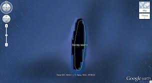
Anyway, from the looks of things we are just about out of time, before the shit hits the fan so to speak. This new Comet coming towards Earth is is going to make life above ground, shall we say, difficult? Because we don’t want to scare anyone. There has been an increase in the frequency and magnitude in earthquakes. We just had another big one 8.1 off the coast of Australia around Sandy Island in the Solomons. Truth is Sandy Island was there and now it’s gone. Sank is more like it.
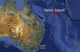
The Rats Deserting the ship. What happened to Sandy Island?
This 8.1 was really a 9.1 because they changed the richter scale to reflect a lower reading. They call it a downgrade, but really it’s a cover up!
Tsunami Slams Solomon Islands
Island of Gizo said to be “entirely washed away and people are floating in the sea”
By Colleen Barry, Newser Staff
Posted Apr 2, 2007 7:01 AM CDT
(Newser) – A tsunami hit the Solomon Islands early Monday morning, killing at least 12 and stranding thousands more. The 8.1 quake brought huge waves nearly a mile inland in some places. “I’m driving down the street — there are boats in the middle of the road, buildings have completely collapsed and fallen down,” said dive shop owner Danny Kennedy.
Devastation is worst on the western island of Gizo. Robert Iroga, editor of the local newspaper, said that unconfirmed reports “suggest that the island was entirely washed away and people are floating in the sea.” The Solomons have been a popular vacation spot for New Zealanders and Australians, and locals are hoping those governments will come through with aid.
2 More Big Quakes Hit Tsunami-Ravaged Solomons
But no more tsunami warnings issued.
By the Associated Press
Posted Feb 8, 2013 6:59 AM CST
(AP) – Strong aftershocks rattled the Solomon Islands today, hampering relief efforts to tsunami-ravaged villages and forcing the South Pacific nation’s prime minister to forgo a visit to the stricken area, where nine deaths have been confirmed. Officials were already struggling to reach the isolated region when a magnitude-6.6 aftershock hit this morning, damaging roads in the island’s main town of Lata and preventing aid workers stationed there from reaching people on the coast.
“We’ve had over 115 aftershocks, but unlike all the others, this one moved vertically up and down. For the first time, it’s created cracks in the roads,” said a relief agency director. A stronger 7.1-magnitude aftershock struck late today. There was no tsunami risk and no immediate reports of damage.
No Damage what the hell are they talking about? An Island disappeared and people are floating in the Ocean but there’s no damage? Well maybe there wasn’t damage in the office were these so called reporters typed these craps stories. But the truth is there was damage.
The Sandy Island is under water and the Rats Deserting the ship with no place to go.
Plus,
Latest Earthquakes Magnitude 2.5 or Greater in the United States and Adjacent Areas and Magnitude 4.5 or Greater in the Rest of the World – Last 7 days
This list contains all earthquakes with magnitude greater than 2.5 located by the USGS and contributing networks in the last week (168 hours). Magnitudes 4.5 and above are in bold font. Magnitudes 6 and above are in red. (Some early events may be obscured by later ones on the maps.)
The most recent earthquakes are at the top of the list. Times are in Coordinated Universal Time (UTC). Click on an event’s “DATE” to get a detailed report.
Update time = Fri Feb 8 15:00:04 UTC 2013
| MAG | UTC DATE-TIME y/m/d h:m:s |
LAT deg |
LON deg |
DEPTH km |
Region | |
|---|---|---|---|---|---|---|
| MAP | 3.3 | 2013/02/08 14:20:19 | 63.638 | -150.782 | 0.3 | CENTRAL ALASKA |
| MAP | 5.2 | 2013/02/08 14:10:38 | -11.108 | 165.872 | 10.0 | SANTA CRUZ ISLANDS |
| MAP | 2.8 | 2013/02/08 14:00:18 | 59.491 | -154.348 | 203.1 | SOUTHERN ALASKA |
| MAP | 4.8 | 2013/02/08 13:39:28 | -10.906 | 165.882 | 9.9 | SANTA CRUZ ISLANDS |
| MAP | 4.9 | 2013/02/08 13:28:09 | -10.852 | 166.785 | 10.1 | SANTA CRUZ ISLANDS |
| MAP | 4.7 | 2013/02/08 12:34:01 | 1.186 | 126.589 | 10.1 | MOLUCCA SEA |
| MAP | 5.1 | 2013/02/08 12:09:20 | -10.967 | 165.882 | 9.9 | SANTA CRUZ ISLANDS |
| MAP | 5.0 | 2013/02/08 12:03:39 | -10.900 | 165.962 | 10.0 | SANTA CRUZ ISLANDS |
| MAP | 5.0 | 2013/02/08 11:56:11 | -10.918 | 165.929 | 10.1 | SANTA CRUZ ISLANDS |
| MAP | 5.1 | 2013/02/08 11:39:42 | -10.948 | 165.895 | 10.1 | SANTA CRUZ ISLANDS |
| MAP | 4.9 | 2013/02/08 11:25:41 | -11.427 | 165.437 | 10.0 | SANTA CRUZ ISLANDS |
| MAP | 2.7 | 2013/02/08 11:23:58 | 61.187 | -149.001 | 250.0 | SOUTHERN ALASKA |
| MAP | 6.8 | 2013/02/08 11:12:13 | -10.904 | 165.895 | 18.0 | SANTA CRUZ ISLANDS |
| MAP | 2.5 | 2013/02/08 10:31:35 | 19.759 | -156.194 | 39.1 | HAWAII REGION, HAWAII |
| MAP | 4.6 | 2013/02/08 09:28:09 | -11.174 | 164.696 | 10.0 | SANTA CRUZ ISLANDS REGION |
| MAP | 4.8 | 2013/02/08 09:18:43 | -11.885 | 165.797 | 10.1 | SANTA CRUZ ISLANDS |
| MAP | 5.3 | 2013/02/08 09:09:02 | -10.914 | 164.739 | 10.0 | SANTA CRUZ ISLANDS REGION |
| MAP | 4.7 | 2013/02/08 08:24:03 | -10.895 | 165.775 | 10.2 | SANTA CRUZ ISLANDS |
| MAP | 4.9 | 2013/02/08 08:15:00 | -11.020 | 165.404 | 10.0 | SANTA CRUZ ISLANDS |
| MAP | 5.3 | 2013/02/08 08:03:36 | -11.030 | 165.672 | 10.0 | SANTA CRUZ ISLANDS |
| MAP | 4.9 | 2013/02/08 07:35:05 | -10.927 | 164.827 | 10.0 | SANTA CRUZ ISLANDS REGION |
| MAP | 4.8 | 2013/02/08 07:04:12 | -10.946 | 164.622 | 10.1 | SANTA CRUZ ISLANDS REGION |
| MAP | 4.5 | 2013/02/08 06:18:41 | -25.505 | -116.418 | 10.0 | SOUTHERN EAST PACIFIC RISE |
| MAP | 4.8 | 2013/02/08 05:29:34 | -11.280 | 165.727 | 10.0 | SANTA CRUZ ISLANDS |
| MAP | 4.6 | 2013/02/08 05:15:51 | 38.057 | 142.936 | 16.4 | NEAR THE EAST COAST OF HONSHU, JAPAN |
| MAP | 2.5 | 2013/02/08 05:07:58 | 19.313 | -155.215 | 8.4 | ISLAND OF HAWAII, HAWAII |
| MAP | 4.7 | 2013/02/08 05:03:48 | -11.020 | 165.721 | 27.7 | SANTA CRUZ ISLANDS |
| MAP | 2.9 | 2013/02/08 04:51:46 | 33.180 | -115.625 | 0.0 | SOUTHERN CALIFORNIA |
| MAP | 4.8 | 2013/02/08 04:48:20 | -10.983 | 164.817 | 15.0 | SANTA CRUZ ISLANDS REGION |
| MAP | 4.5 | 2013/02/08 04:38:11 | 36.555 | 71.423 | 108.5 | HINDU KUSH REGION, AFGHANISTAN |
| MAP | 5.3 | 2013/02/08 04:26:17 | -11.096 | 165.730 | 15.4 | SANTA CRUZ ISLANDS |
| MAP | 4.6 | 2013/02/08 04:23:39 | -10.501 | 165.633 | 15.0 | SANTA CRUZ ISLANDS |
| MAP | 4.5 | 2013/02/08 03:54:42 | 30.495 | 69.543 | 10.0 | PAKISTAN |
| MAP | 2.6 | 2013/02/08 03:39:29 | 18.517 | -64.984 | 34.0 | VIRGIN ISLANDS REGION |
| MAP | 2.8 | 2013/02/08 03:19:53 | 37.786 | -113.125 | 4.7 | UTAH |
| MAP | 3.7 | 2013/02/08 02:47:03 | 37.773 | -113.129 | 0.2 | UTAH |
| MAP | 4.7 | 2013/02/08 02:00:13 | -10.722 | 165.322 | 10.0 | SANTA CRUZ ISLANDS |
| MAP | 4.7 | 2013/02/08 00:54:16 | 39.149 | 142.927 | 39.0 | NEAR THE EAST COAST OF HONSHU, JAPAN |
| MAP | 4.8 | 2013/02/08 00:25:58 | -11.071 | 165.881 | 10.0 | SANTA CRUZ ISLANDS |
| MAP | 5.1 | 2013/02/08 00:12:58 | -11.738 | 165.462 | 15.4 | SANTA CRUZ ISLANDS |
| MAG | UTC DATE-TIME y/m/d h:m:s |
LAT deg |
LON deg |
DEPTH km |
Region | |
|---|---|---|---|---|---|---|
| MAP | 3.6 | 2013/02/07 23:19:08 | 53.409 | 6.594 | 9.9 | THE NETHERLANDS |
| MAP | 4.8 | 2013/02/07 22:48:00 | 29.253 | 142.003 | 33.3 | IZU ISLANDS, JAPAN REGION |
| MAP | 4.8 | 2013/02/07 21:56:24 | -10.893 | 165.602 | 10.0 | SANTA CRUZ ISLANDS |
| MAP | 5.1 | 2013/02/07 21:40:56 | -10.901 | 165.738 | 25.5 | SANTA CRUZ ISLANDS |
| MAP | 5.1 | 2013/02/07 21:38:25 | -4.377 | 142.992 | 97.8 | NEW GUINEA, PAPUA NEW GUINEA |
| MAP | 4.9 | 2013/02/07 20:51:52 | -10.890 | 165.068 | 10.0 | SANTA CRUZ ISLANDS |
| MAP | 5.0 | 2013/02/07 20:45:19 | -10.909 | 165.773 | 10.0 | SANTA CRUZ ISLANDS |
| MAP | 4.7 | 2013/02/07 20:41:37 | -0.389 | 124.356 | 48.0 | MOLUCCA SEA |
| MAP | 5.2 | 2013/02/07 20:20:07 | -10.855 | 165.706 | 10.0 | SANTA CRUZ ISLANDS |
| MAP | 3.5 | 2013/02/07 20:02:22 | 37.788 | -113.124 | 2.1 | UTAH |
| MAP | 5.5 | 2013/02/07 19:48:19 | -10.872 | 165.717 | 10.2 | SANTA CRUZ ISLANDS |
| MAP | 4.9 | 2013/02/07 19:43:13 | -11.023 | 165.629 | 10.0 | SANTA CRUZ ISLANDS |
| MAP | 3.1 | 2013/02/07 19:29:56 | 37.804 | -113.106 | 2.4 | UTAH |
| MAP | 5.0 | 2013/02/07 19:25:15 | -10.983 | 165.677 | 9.9 | SANTA CRUZ ISLANDS |
| MAP | 6.6 | 2013/02/07 18:59:16 | -11.001 | 165.658 | 10.0 | SANTA CRUZ ISLANDS |
| MAP | 4.8 | 2013/02/07 17:59:01 | -10.939 | 165.521 | 10.0 | SANTA CRUZ ISLANDS |
| MAP | 2.9 | 2013/02/07 17:58:48 | 18.840 | -67.250 | 11.0 | PUERTO RICO REGION |
| MAP | 5.1 | 2013/02/07 17:49:47 | -11.238 | 165.921 | 14.2 | SANTA CRUZ ISLANDS |
| MAP | 2.6 | 2013/02/07 17:21:48 | 18.488 | -65.287 | 102.0 | PUERTO RICO REGION |
| MAP | 4.3 | 2013/02/07 15:37:28 | -21.087 | -67.425 | 173.2 | POTOSI, BOLIVIA |
| MAP | 4.7 | 2013/02/07 15:22:40 | -5.622 | 103.260 | 63.3 | SOUTHERN SUMATRA, INDONESIA |
| MAP | 5.0 | 2013/02/07 15:05:11 | -11.010 | 165.587 | 35.0 | SANTA CRUZ ISLANDS |
| MAP | 3.0 | 2013/02/07 15:04:39 | 37.406 | -118.600 | 12.0 | CENTRAL CALIFORNIA |
| MAP | 5.0 | 2013/02/07 14:05:56 | -11.028 | 164.816 | 10.1 | SANTA CRUZ ISLANDS REGION |
| MAP | 4.8 | 2013/02/07 13:46:37 | -10.826 | 165.675 | 10.0 | SANTA CRUZ ISLANDS |
| MAP | 4.8 | 2013/02/07 13:23:18 | -10.768 | 165.434 | 16.2 | SANTA CRUZ ISLANDS |
| MAP | 5.1 | 2013/02/07 12:36:49 | -10.823 | 165.173 | 10.2 | SANTA CRUZ ISLANDS |
| MAP | 4.9 | 2013/02/07 11:30:17 | -8.687 | 168.268 | 15.2 | SANTA CRUZ ISLANDS REGION |
| MAP | 3.5 | 2013/02/07 11:16:31 | 55.961 | -135.285 | 10.0 | OFF THE COAST OF SOUTHEASTERN ALASKA |
| MAP | 4.8 | 2013/02/07 10:23:30 | -10.672 | 164.875 | 21.3 | SANTA CRUZ ISLANDS REGION |
| MAP | 3.2 | 2013/02/07 10:14:30 | 18.794 | -64.447 | 53.0 | VIRGIN ISLANDS REGION |
| MAP | 4.7 | 2013/02/07 09:50:08 | -11.048 | 164.820 | 10.0 | SANTA CRUZ ISLANDS REGION |
| MAP | 2.6 | 2013/02/07 09:40:38 | 18.595 | -65.199 | 78.0 | PUERTO RICO REGION |
| MAP | 3.1 | 2013/02/07 09:39:04 | 66.075 | -148.229 | 0.1 | NORTHERN ALASKA |
| MAP | 4.5 | 2013/02/07 09:36:55 | -6.607 | -74.291 | 163.1 | NORTHERN PERU |
| MAP | 4.7 | 2013/02/07 08:20:42 | -10.690 | 164.597 | 10.2 | SANTA CRUZ ISLANDS REGION |
| MAP | 6.1 | 2013/02/07 08:03:41 | -11.025 | 164.750 | 10.0 | SANTA CRUZ ISLANDS REGION |
| MAP | 4.9 | 2013/02/07 08:03:30 | 0.245 | 98.498 | 35.2 | NIAS REGION, INDONESIA |
| MAP | 4.8 | 2013/02/07 07:38:19 | -33.653 | 77.585 | 10.0 | MID-INDIAN RIDGE |
| MAP | 5.1 | 2013/02/07 07:19:51 | -15.586 | -173.142 | 10.0 | TONGA |
| MAP | 5.3 | 2013/02/07 07:11:20 | -10.972 | 165.492 | 10.0 | SANTA CRUZ ISLANDS |
| MAP | 2.9 | 2013/02/07 06:40:02 | 18.729 | -64.280 | 41.0 | VIRGIN ISLANDS REGION |
| MAP | 3.1 | 2013/02/07 05:30:18 | 45.410 | -71.440 | 5.0 | SOUTHERN QUEBEC, CANADA |
| MAP | 4.5 | 2013/02/07 05:27:41 | -21.200 | -176.565 | 229.7 | FIJI REGION |
| MAP | 3.7 | 2013/02/07 05:20:26 | 17.110 | -68.490 | 9.0 | DOMINICAN REPUBLIC REGION |
| MAP | 5.0 | 2013/02/07 03:52:57 | -11.669 | 165.050 | 35.0 | SANTA CRUZ ISLANDS |
| MAP | 2.5 | 2013/02/07 03:21:37 | 60.245 | -152.107 | 79.0 | SOUTHERN ALASKA |
| MAP | 4.9 | 2013/02/07 03:00:00 | -11.430 | 165.204 | 35.0 | SANTA CRUZ ISLANDS |
| MAP | 4.9 | 2013/02/07 02:56:29 | -10.736 | 165.442 | 27.2 | SANTA CRUZ ISLANDS |
| MAP | 4.8 | 2013/02/07 02:46:08 | -10.767 | 165.265 | 24.6 | SANTA CRUZ ISLANDS |
| MAP | 4.9 | 2013/02/07 02:42:29 | -11.753 | 164.950 | 26.6 | SANTA CRUZ ISLANDS REGION |
| MAP | 5.2 | 2013/02/07 02:17:25 | -10.636 | 164.823 | 52.0 | SANTA CRUZ ISLANDS REGION |
| MAP | 2.6 | 2013/02/07 01:09:13 | 64.055 | -148.933 | 12.4 | CENTRAL ALASKA |
| MAP | 5.2 | 2013/02/07 01:00:49 | -11.819 | 164.824 | 34.2 | SANTA CRUZ ISLANDS REGION |
| MAP | 5.1 | 2013/02/07 00:56:47 | -11.667 | 164.782 | 35.1 | SANTA CRUZ ISLANDS REGION |
| MAP | 5.1 | 2013/02/07 00:41:32 | 1.425 | 98.935 | 82.8 | NORTHERN SUMATRA, INDONESIA |
| MAP | 6.2 | 2013/02/07 00:30:11 | -11.664 | 164.960 | 9.8 | SANTA CRUZ ISLANDS REGION |
| MAP | 2.8 | 2013/02/07 00:28:31 | 52.865 | -173.600 | 162.9 | ANDREANOF ISLANDS, ALEUTIAN IS., ALASKA |
| MAP | 4.8 | 2013/02/07 00:16:28 | -10.826 | 164.877 | 24.7 | SANTA CRUZ ISLANDS REGION |
| MAG | UTC DATE-TIME y/m/d h:m:s |
LAT deg |
LON deg |
DEPTH km |
Region | |
|---|---|---|---|---|---|---|
| MAP | 5.2 | 2013/02/06 23:49:35 | -11.770 | 164.942 | 10.5 | SANTA CRUZ ISLANDS REGION |
| MAP | 5.0 | 2013/02/06 23:39:01 | -11.767 | 164.787 | 10.5 | SANTA CRUZ ISLANDS REGION |
| MAP | 5.0 | 2013/02/06 23:30:28 | -10.775 | 165.033 | 10.2 | SANTA CRUZ ISLANDS |
| MAP | 4.8 | 2013/02/06 23:23:52 | -10.861 | 165.304 | 9.4 | SANTA CRUZ ISLANDS |
| MAP | 5.0 | 2013/02/06 22:24:27 | -10.957 | 165.441 | 10.0 | SANTA CRUZ ISLANDS |
| MAP | 5.5 | 2013/02/06 22:20:18 | -11.091 | 165.666 | 9.9 | SANTA CRUZ ISLANDS |
| MAP | 5.5 | 2013/02/06 22:12:18 | -1.483 | 100.322 | 11.3 | SOUTHERN SUMATRA, INDONESIA |
| MAP | 4.9 | 2013/02/06 22:07:39 | -12.154 | 165.995 | 10.0 | SANTA CRUZ ISLANDS |
| MAP | 4.9 | 2013/02/06 21:37:36 | -11.191 | 165.742 | 10.3 | SANTA CRUZ ISLANDS |
| MAP | 5.1 | 2013/02/06 20:42:31 | -23.225 | 170.855 | 10.2 | SOUTHEAST OF THE LOYALTY ISLANDS |
| MAP | 5.0 | 2013/02/06 20:18:40 | 46.506 | -27.373 | 14.1 | NORTHERN MID-ATLANTIC RIDGE |
| MAP | 2.6 | 2013/02/06 19:49:47 | 37.386 | -118.677 | 14.2 | CENTRAL CALIFORNIA |
| MAP | 4.9 | 2013/02/06 19:01:49 | 34.321 | 80.463 | 35.1 | WESTERN XIZANG |
| MAP | 2.7 | 2013/02/06 18:47:02 | 37.783 | -113.128 | 7.5 | UTAH |
| MAP | 4.1 | 2013/02/06 18:24:58 | 36.617 | 71.064 | 211.6 | HINDU KUSH REGION, AFGHANISTAN |
| MAP | 4.9 | 2013/02/06 18:17:33 | -11.070 | 165.012 | 10.0 | SANTA CRUZ ISLANDS |
| MAP | 5.0 | 2013/02/06 18:03:20 | -11.178 | 165.628 | 10.1 | SANTA CRUZ ISLANDS |
| MAP | 5.0 | 2013/02/06 17:19:32 | -11.645 | 165.037 | 10.1 | SANTA CRUZ ISLANDS |
| MAP | 3.0 | 2013/02/06 17:07:16 | 19.548 | -64.250 | 65.0 | VIRGIN ISLANDS REGION |
| MAP | 5.0 | 2013/02/06 17:04:08 | -10.693 | 164.886 | 10.0 | SANTA CRUZ ISLANDS REGION |
| MAP | 5.0 | 2013/02/06 16:39:30 | -10.678 | 164.812 | 10.0 | SANTA CRUZ ISLANDS REGION |
| MAP | 5.0 | 2013/02/06 16:35:54 | -11.295 | 165.632 | 10.1 | SANTA CRUZ ISLANDS |
| MAP | 4.3 | 2013/02/06 16:10:14 | 30.879 | 50.060 | 35.0 | SOUTHERN IRAN |
| MAP | 2.7 | 2013/02/06 16:05:50 | 36.592 | -121.052 | 8.0 | CENTRAL CALIFORNIA |
| MAP | 5.3 | 2013/02/06 15:54:15 | -10.931 | 165.428 | 10.1 | SANTA CRUZ ISLANDS |
| MAP | 5.0 | 2013/02/06 15:30:25 | -10.812 | 164.487 | 10.0 | SANTA CRUZ ISLANDS REGION |
| MAP | 5.1 | 2013/02/06 14:24:05 | -11.252 | 165.116 | 10.0 | SANTA CRUZ ISLANDS |
| MAP | 5.3 | 2013/02/06 14:20:57 | -10.947 | 165.442 | 10.0 | SANTA CRUZ ISLANDS |
| MAP | 2.5 | 2013/02/06 14:18:29 | 18.681 | -65.003 | 56.0 | VIRGIN ISLANDS REGION |
| MAP | 5.0 | 2013/02/06 14:03:51 | -11.345 | 165.069 | 10.0 | SANTA CRUZ ISLANDS |
| MAP | 6.0 | 2013/02/06 13:54:54 | -10.798 | 166.492 | 10.1 | SANTA CRUZ ISLANDS |
| MAP | 5.3 | 2013/02/06 13:50:33 | -10.533 | 166.385 | 10.0 | SANTA CRUZ ISLANDS |
| MAP | 4.9 | 2013/02/06 13:37:06 | -11.093 | 165.082 | 10.0 | SANTA CRUZ ISLANDS |
| MAP | 4.9 | 2013/02/06 12:58:46 | -11.262 | 165.776 | 10.0 | SANTA CRUZ ISLANDS |
| MAP | 5.5 | 2013/02/06 12:44:29 | -11.582 | 165.499 | 9.8 | SANTA CRUZ ISLANDS |
| MAP | 4.9 | 2013/02/06 12:31:56 | -1.041 | 146.923 | 34.5 | ADMIRALTY ISLANDS REG., PAPUA NEW GUINEA |
| MAP | 2.6 | 2013/02/06 12:28:52 | 40.167 | -121.121 | 0.0 | NORTHERN CALIFORNIA |
| MAP | 4.9 | 2013/02/06 12:04:41 | -10.791 | 165.943 | 10.1 | SANTA CRUZ ISLANDS |
| MAP | 5.9 | 2013/02/06 11:53:54 | -11.255 | 165.734 | 9.9 | SANTA CRUZ ISLANDS |
| MAP | 5.1 | 2013/02/06 11:24:03 | -10.798 | 164.580 | 9.9 | SANTA CRUZ ISLANDS REGION |
| MAP | 3.3 | 2013/02/06 11:05:14 | 19.554 | -64.637 | 39.0 | VIRGIN ISLANDS REGION |
| MAP | 5.6 | 2013/02/06 11:03:46 | -10.730 | 165.137 | 9.8 | SANTA CRUZ ISLANDS |
| MAP | 5.7 | 2013/02/06 10:33:18 | -10.636 | 164.808 | 9.9 | SANTA CRUZ ISLANDS REGION |
| MAP | 4.9 | 2013/02/06 10:27:27 | -10.841 | 164.721 | 10.0 | SANTA CRUZ ISLANDS REGION |
| MAP | 5.5 | 2013/02/06 10:20:34 | -10.870 | 165.272 | 10.0 | SANTA CRUZ ISLANDS |
| MAP | 5.3 | 2013/02/06 10:12:30 | -11.115 | 165.379 | 10.0 | SANTA CRUZ ISLANDS |
| MAP | 4.9 | 2013/02/06 10:00:15 | -12.066 | 165.795 | 10.0 | SANTA CRUZ ISLANDS |
| MAP | 5.2 | 2013/02/06 09:24:00 | -10.718 | 164.228 | 9.6 | SANTA CRUZ ISLANDS REGION |
| MAP | 5.0 | 2013/02/06 08:45:05 | -11.670 | 165.468 | 10.3 | SANTA CRUZ ISLANDS |
| MAP | 4.7 | 2013/02/06 08:42:27 | -10.998 | 165.501 | 10.0 | SANTA CRUZ ISLANDS |
| MAP | 4.7 | 2013/02/06 08:27:04 | -10.782 | 165.531 | 9.9 | SANTA CRUZ ISLANDS |
| MAP | 5.0 | 2013/02/06 08:04:36 | -15.988 | -172.223 | 34.0 | SAMOA ISLANDS REGION |
| MAP | 4.4 | 2013/02/06 07:59:53 | 53.670 | -163.204 | 22.2 | UNIMAK ISLAND REGION, ALASKA |
| MAP | 4.9 | 2013/02/06 07:57:53 | -11.287 | 165.492 | 9.9 | SANTA CRUZ ISLANDS |
| MAP | 4.8 | 2013/02/06 07:42:46 | -11.001 | 165.476 | 10.1 | SANTA CRUZ ISLANDS |
| MAP | 4.7 | 2013/02/06 07:35:58 | -10.744 | 164.862 | 10.0 | SANTA CRUZ ISLANDS REGION |
| MAP | 4.8 | 2013/02/06 07:29:30 | -11.547 | 165.159 | 10.0 | SANTA CRUZ ISLANDS |
| MAP | 5.0 | 2013/02/06 07:23:12 | -10.901 | 165.356 | 10.1 | SANTA CRUZ ISLANDS |
| MAP | 5.3 | 2013/02/06 07:13:48 | -10.637 | 165.305 | 10.1 | SANTA CRUZ ISLANDS |
| MAP | 5.6 | 2013/02/06 06:53:20 | -10.635 | 164.967 | 10.0 | SANTA CRUZ ISLANDS REGION |
| MAP | 6.3 | 2013/02/06 06:35:20 | -10.784 | 164.512 | 10.1 | SANTA CRUZ ISLANDS REGION |
| MAP | 5.2 | 2013/02/06 06:09:37 | -11.071 | 164.811 | 10.0 | SANTA CRUZ ISLANDS REGION |
| MAP | 5.2 | 2013/02/06 06:02:37 | -10.780 | 164.571 | 10.0 | SANTA CRUZ ISLANDS REGION |
| MAP | 4.9 | 2013/02/06 05:58:42 | -10.800 | 165.231 | 10.1 | SANTA CRUZ ISLANDS |
| MAP | 5.2 | 2013/02/06 05:48:54 | -11.066 | 164.756 | 10.3 | SANTA CRUZ ISLANDS REGION |
| MAP | 4.8 | 2013/02/06 05:48:17 | -10.694 | 165.600 | 10.1 | SANTA CRUZ ISLANDS |
| MAP | 5.0 | 2013/02/06 05:35:34 | -10.745 | 165.326 | 15.0 | SANTA CRUZ ISLANDS |
| MAP | 5.1 | 2013/02/06 05:30:19 | -10.682 | 164.272 | 9.8 | SANTA CRUZ ISLANDS REGION |
| MAP | 5.1 | 2013/02/06 05:24:31 | -11.433 | 165.367 | 15.1 | SANTA CRUZ ISLANDS |
| MAP | 5.3 | 2013/02/06 05:16:27 | -10.426 | 166.498 | 11.9 | SANTA CRUZ ISLANDS |
| MAP | 5.2 | 2013/02/06 05:13:49 | -10.620 | 166.298 | 15.1 | SANTA CRUZ ISLANDS |
| MAP | 4.9 | 2013/02/06 05:04:05 | -11.030 | 165.474 | 10.0 | SANTA CRUZ ISLANDS |
| MAP | 5.2 | 2013/02/06 05:01:51 | -11.408 | 165.057 | 9.9 | SANTA CRUZ ISLANDS |
| MAP | 5.0 | 2013/02/06 04:56:19 | -11.302 | 165.130 | 16.0 | SANTA CRUZ ISLANDS |
| MAP | 3.3 | 2013/02/06 04:55:36 | 19.590 | -64.789 | 7.0 | VIRGIN ISLANDS REGION |
| MAP | 3.1 | 2013/02/06 04:44:52 | 19.354 | -155.815 | 28.4 | ISLAND OF HAWAII, HAWAII |
| MAP | 5.1 | 2013/02/06 04:34:51 | -11.396 | 164.847 | 35.2 | SANTA CRUZ ISLANDS REGION |
| MAP | 5.2 | 2013/02/06 04:20:55 | -10.910 | 165.571 | 34.9 | SANTA CRUZ ISLANDS |
| MAP | 5.0 | 2013/02/06 04:20:04 | -10.883 | 165.405 | 10.1 | SANTA CRUZ ISLANDS |
| MAP | 5.0 | 2013/02/06 04:16:30 | -11.092 | 164.904 | 10.7 | SANTA CRUZ ISLANDS REGION |
| MAP | 3.0 | 2013/02/06 04:05:58 | 18.987 | -64.203 | 50.0 | VIRGIN ISLANDS REGION |
| MAP | 2.8 | 2013/02/06 04:05:31 | 38.830 | -122.833 | 0.7 | NORTHERN CALIFORNIA |
| MAP | 5.6 | 2013/02/06 03:49:47 | -10.893 | 165.474 | 18.3 | SANTA CRUZ ISLANDS |
| MAP | 5.3 | 2013/02/06 03:45:10 | -10.669 | 165.312 | 33.4 | SANTA CRUZ ISLANDS |
| MAP | 5.2 | 2013/02/06 03:38:55 | -10.890 | 165.268 | 12.1 | SANTA CRUZ ISLANDS |
| MAP | 5.3 | 2013/02/06 03:28:55 | -11.053 | 165.446 | 22.8 | SANTA CRUZ ISLANDS |
| MAP | 5.1 | 2013/02/06 03:25:19 | -11.130 | 165.806 | 9.9 | SANTA CRUZ ISLANDS |
| MAP | 5.3 | 2013/02/06 03:19:06 | -10.896 | 165.216 | 14.9 | SANTA CRUZ ISLANDS |
| MAP | 5.2 | 2013/02/06 03:11:53 | -10.935 | 165.292 | 36.8 | SANTA CRUZ ISLANDS |
| MAP | 5.1 | 2013/02/06 03:06:34 | -11.513 | 165.326 | 10.0 | SANTA CRUZ ISLANDS |
| MAP | 5.6 | 2013/02/06 03:01:03 | -11.032 | 165.106 | 20.4 | SANTA CRUZ ISLANDS |
| MAP | 5.5 | 2013/02/06 02:58:22 | -10.663 | 165.128 | 16.9 | SANTA CRUZ ISLANDS |
| MAP | 5.1 | 2013/02/06 02:57:45 | -10.755 | 165.026 | 38.1 | SANTA CRUZ ISLANDS |
| MAP | 4.9 | 2013/02/06 02:44:27 | -11.295 | 165.111 | 38.4 | SANTA CRUZ ISLANDS |
| MAP | 5.6 | 2013/02/06 02:30:49 | -10.822 | 164.980 | 32.5 | SANTA CRUZ ISLANDS REGION |
| MAP | 2.6 | 2013/02/06 02:27:19 | 19.208 | -155.536 | 37.2 | ISLAND OF HAWAII, HAWAII |
| MAP | 5.3 | 2013/02/06 02:23:12 | -10.963 | 165.402 | 28.3 | SANTA CRUZ ISLANDS |
| MAP | 5.2 | 2013/02/06 02:18:15 | -11.468 | 165.614 | 34.4 | SANTA CRUZ ISLANDS |
| MAP | 5.2 | 2013/02/06 02:06:21 | -10.597 | 165.363 | 10.0 | SANTA CRUZ ISLANDS |
| MAP | 7.0 | 2013/02/06 01:54:15 | -10.479 | 165.772 | 9.8 | SANTA CRUZ ISLANDS |
| MAP | 5.7 | 2013/02/06 01:48:43 | -11.628 | 165.937 | 10.0 | SANTA CRUZ ISLANDS |
| MAP | 5.6 | 2013/02/06 01:33:37 | -10.922 | 165.085 | 10.0 | SANTA CRUZ ISLANDS |
| MAP | 7.1 | 2013/02/06 01:23:20 | -11.254 | 164.932 | 10.1 | SANTA CRUZ ISLANDS REGION |
| MAP | 5.6 | 2013/02/06 01:22:13 | -11.366 | 165.768 | 10.1 | SANTA CRUZ ISLANDS |
| MAP | 8.0 | 2013/02/06 01:12:27 | -10.738 | 165.138 | 28.7 | SANTA CRUZ ISLANDS |
| MAP | 4.6 | 2013/02/06 01:00:47 | -4.352 | 134.710 | 32.8 | NEAR THE SOUTH COAST OF PAPUA, INDONESIA |
| MAP | 5.3 | 2013/02/06 00:46:01 | -10.871 | 165.029 | 9.5 | SANTA CRUZ ISLANDS |
| MAP | 2.7 | 2013/02/06 00:11:10 | 19.027 | -64.743 | 44.0 | VIRGIN ISLANDS REGION |
| MAP | 6.3 | 2013/02/06 00:07:23 | -10.858 | 165.206 | 10.0 | SANTA CRUZ ISLANDS |
| MAG | UTC DATE-TIME y/m/d h:m:s |
LAT deg |
LON deg |
DEPTH km |
Region | |
|---|---|---|---|---|---|---|
| MAP | 3.5 | 2013/02/05 22:03:51 | 40.423 | -125.319 | 2.5 | OFFSHORE NORTHERN CALIFORNIA |
| MAP | 4.7 | 2013/02/05 20:15:10 | -23.609 | -66.720 | 204.9 | JUJUY, ARGENTINA |
| MAP | 2.5 | 2013/02/05 19:49:16 | 52.221 | -168.201 | 39.1 | FOX ISLANDS, ALEUTIAN ISLANDS, ALASKA |
| MAP | 5.1 | 2013/02/05 19:39:39 | -10.753 | 164.986 | 46.0 | SANTA CRUZ ISLANDS REGION |
| MAP | 3.3 | 2013/02/05 19:11:12 | 19.248 | -66.248 | 66.0 | PUERTO RICO REGION |
| MAP | 5.0 | 2013/02/05 19:09:38 | -62.305 | 155.073 | 32.8 | BALLENY ISLANDS REGION |
| MAP | 3.6 | 2013/02/05 18:40:34 | 19.721 | -68.543 | 41.0 | DOMINICAN REPUBLIC REGION |
| MAP | 4.8 | 2013/02/05 18:18:31 | 36.483 | 70.577 | 214.9 | HINDU KUSH REGION, AFGHANISTAN |
| MAP | 4.4 | 2013/02/05 17:30:50 | -22.682 | -68.968 | 84.1 | ANTOFAGASTA, CHILE |
| MAP | 2.7 | 2013/02/05 17:10:30 | 59.321 | -152.657 | 49.7 | SOUTHERN ALASKA |
| MAP | 4.9 | 2013/02/05 16:38:02 | 55.443 | -35.032 | 5.8 | REYKJANES RIDGE |
| MAP | 5.0 | 2013/02/05 16:15:32 | 28.802 | 128.595 | 57.3 | RYUKYU ISLANDS, JAPAN |
| MAP | 5.0 | 2013/02/05 15:40:09 | -56.138 | -25.231 | 48.9 | SOUTH SANDWICH ISLANDS REGION |
| MAP | 2.6 | 2013/02/05 15:27:27 | 59.775 | -153.234 | 134.8 | SOUTHERN ALASKA |
| MAP | 2.7 | 2013/02/05 14:42:02 | 34.071 | -117.237 | 14.4 | GREATER LOS ANGELES AREA, CALIFORNIA |
| MAP | 4.8 | 2013/02/05 13:31:04 | 38.701 | 142.000 | 51.4 | NEAR THE EAST COAST OF HONSHU, JAPAN |
| MAP | 2.9 | 2013/02/05 13:24:31 | 63.361 | -150.796 | 11.2 | CENTRAL ALASKA |
| MAP | 4.1 | 2013/02/05 13:13:49 | 38.916 | 99.914 | 6.3 | NORTHERN QINGHAI, CHINA |
| MAP | 4.4 | 2013/02/05 12:43:21 | 33.107 | 140.579 | 79.2 | IZU ISLANDS, JAPAN REGION |
| MAP | 3.3 | 2013/02/05 12:16:41 | 19.303 | -68.612 | 90.0 | DOMINICAN REPUBLIC REGION |
| MAP | 3.3 | 2013/02/05 10:24:41 | 38.003 | -115.453 | 4.0 | NEVADA |
| MAP | 2.5 | 2013/02/05 08:58:22 | 35.072 | -118.966 | 12.4 | CENTRAL CALIFORNIA |
| MAP | 4.3 | 2013/02/05 08:55:29 | 12.141 | -88.548 | 35.0 | OFF THE COAST OF EL SALVADOR |
| MAP | 2.8 | 2013/02/05 07:55:09 | 51.583 | -178.442 | 4.8 | ANDREANOF ISLANDS, ALEUTIAN IS., ALASKA |
| MAP | 2.9 | 2013/02/05 06:25:49 | 53.176 | -161.233 | 25.7 | SOUTH OF ALASKA |
| MAP | 3.1 | 2013/02/05 06:07:50 | 32.161 | -115.211 | 18.7 | BAJA CALIFORNIA, MEXICO |
| MAP | 3.1 | 2013/02/05 05:04:50 | 19.008 | -64.205 | 56.0 | VIRGIN ISLANDS REGION |
| MAP | 3.2 | 2013/02/05 04:52:57 | 18.893 | -64.212 | 53.0 | VIRGIN ISLANDS REGION |
| MAP | 2.5 | 2013/02/05 04:27:33 | 36.002 | -120.562 | 4.8 | CENTRAL CALIFORNIA |
| MAP | 4.9 | 2013/02/05 03:57:30 | 14.036 | 92.950 | 28.7 | ANDAMAN ISLANDS, INDIA REGION |
| MAP | 2.5 | 2013/02/05 03:30:56 | 59.047 | -150.069 | 5.0 | KENAI PENINSULA, ALASKA |
| MAP | 5.0 | 2013/02/05 03:24:52 | 45.519 | 151.286 | 46.9 | KURIL ISLANDS |
| MAP | 2.5 | 2013/02/05 02:08:36 | 36.971 | -121.614 | 2.7 | NORTHERN CALIFORNIA |
| MAP | 3.4 | 2013/02/05 01:33:26 | 51.879 | -174.037 | 37.3 | ANDREANOF ISLANDS, ALEUTIAN IS., ALASKA |
| MAG | UTC DATE-TIME y/m/d h:m:s |
LAT deg |
LON deg |
DEPTH km |
Region | |
|---|---|---|---|---|---|---|
| MAP | 3.1 | 2013/02/04 21:15:06 | 18.869 | -64.321 | 39.0 | VIRGIN ISLANDS REGION |
| MAP | 2.5 | 2013/02/04 21:04:52 | 18.912 | -64.329 | 39.0 | VIRGIN ISLANDS REGION |
| MAP | 3.0 | 2013/02/04 20:56:03 | 18.830 | -64.265 | 43.0 | VIRGIN ISLANDS REGION |
| MAP | 2.6 | 2013/02/04 18:49:47 | 38.123 | -115.037 | 13.7 | NEVADA |
| MAP | 2.9 | 2013/02/04 18:30:52 | 38.789 | -122.743 | 1.9 | NORTHERN CALIFORNIA |
| MAP | 4.7 | 2013/02/04 17:47:50 | 37.527 | 70.176 | 14.0 | HINDU KUSH REGION, AFGHANISTAN |
| MAP | 2.6 | 2013/02/04 17:06:37 | 60.682 | -152.405 | 91.3 | SOUTHERN ALASKA |
| MAP | 4.1 | 2013/02/04 15:27:14 | 32.900 | 94.897 | 27.5 | XIZANG-QINGHAI BORDER REGION |
| MAP | 4.7 | 2013/02/04 14:33:03 | -11.008 | 165.443 | 10.0 | SANTA CRUZ ISLANDS |
| MAP | 3.1 | 2013/02/04 13:51:14 | 49.937 | 179.169 | 49.9 | SOUTH OF THE ALEUTIAN ISLANDS |
| MAP | 4.7 | 2013/02/04 13:35:29 | 37.534 | 82.426 | 21.7 | SOUTHERN XINJIANG, CHINA |
| MAP | 4.7 | 2013/02/04 12:04:58 | 32.853 | 94.712 | 35.0 | XIZANG-QINGHAI BORDER REGION |
| MAP | 4.6 | 2013/02/04 11:48:42 | -33.999 | -14.713 | 10.1 | SOUTHERN MID-ATLANTIC RIDGE |
| MAP | 4.7 | 2013/02/04 09:33:18 | 0.630 | 126.242 | 14.7 | MOLUCCA SEA |
| MAP | 4.3 | 2013/02/04 08:38:06 | 36.562 | 70.815 | 204.3 | HINDU KUSH REGION, AFGHANISTAN |
| MAP | 4.6 | 2013/02/04 08:08:31 | 19.024 | 121.052 | 48.9 | BABUYAN ISLANDS REGION, PHILIPPINES |
| MAP | 4.7 | 2013/02/04 07:56:53 | 34.892 | 24.192 | 10.0 | CRETE, GREECE |
| MAP | 4.6 | 2013/02/04 07:16:10 | 16.222 | 120.579 | 54.9 | LUZON, PHILIPPINES |
| MAP | 4.0 | 2013/02/04 05:39:06 | 16.883 | -96.751 | 35.0 | OAXACA, MEXICO |
| MAP | 3.1 | 2013/02/04 05:25:34 | 62.325 | -151.367 | 81.6 | CENTRAL ALASKA |
| MAP | 4.3 | 2013/02/04 05:10:32 | 15.319 | -94.031 | 72.8 | OFFSHORE CHIAPAS, MEXICO |
| MAP | 4.5 | 2013/02/04 04:29:47 | 43.681 | 16.390 | 10.1 | CROATIA |
| MAP | 4.7 | 2013/02/04 04:00:54 | 30.334 | 130.995 | 54.3 | KYUSHU, JAPAN |
| MAP | 2.7 | 2013/02/04 03:50:17 | 18.697 | -64.309 | 73.0 | VIRGIN ISLANDS REGION |
| MAP | 4.6 | 2013/02/04 03:49:28 | -4.971 | 133.910 | 21.8 | NEAR THE SOUTH COAST OF PAPUA, INDONESIA |
| MAP | 2.5 | 2013/02/04 03:46:17 | 48.936 | -119.581 | 1.2 | WASHINGTON |
| MAP | 2.5 | 2013/02/04 03:31:00 | 51.437 | -177.221 | 37.6 | ANDREANOF ISLANDS, ALEUTIAN IS., ALASKA |
| MAP | 2.6 | 2013/02/04 01:54:44 | 51.575 | -176.749 | 49.5 | ANDREANOF ISLANDS, ALEUTIAN IS., ALASKA |
| MAP | 2.9 | 2013/02/04 01:38:58 | 18.885 | -64.917 | 55.0 | VIRGIN ISLANDS REGION |
| MAP | 4.7 | 2013/02/04 01:20:21 | -5.547 | 130.837 | 58.7 | BANDA SEA |
| MAG | UTC DATE-TIME y/m/d h:m:s |
LAT deg |
LON deg |
DEPTH km |
Region | |
|---|---|---|---|---|---|---|
| MAP | 5.1 | 2013/02/03 23:04:18 | 29.330 | 141.802 | 48.8 | IZU ISLANDS, JAPAN REGION |
| MAP | 5.3 | 2013/02/03 22:56:12 | 29.312 | 142.014 | 34.8 | IZU ISLANDS, JAPAN REGION |
| MAP | 2.7 | 2013/02/03 22:14:27 | 35.805 | -118.504 | 4.5 | CENTRAL CALIFORNIA |
| MAP | 3.0 | 2013/02/03 22:01:44 | 61.689 | -150.567 | 66.6 | SOUTHERN ALASKA |
| MAP | 3.2 | 2013/02/03 21:37:57 | 62.998 | -150.581 | 104.8 | CENTRAL ALASKA |
| MAP | 4.7 | 2013/02/03 20:54:44 | -32.377 | -71.598 | 37.9 | OFFSHORE VALPARAISO, CHILE |
| MAP | 3.6 | 2013/02/03 20:30:44 | 67.733 | -167.164 | 24.2 | BERING STRAIT |
| MAP | 4.5 | 2013/02/03 17:47:00 | 27.692 | 56.497 | 45.1 | SOUTHERN IRAN |
| MAP | 2.5 | 2013/02/03 16:51:47 | 37.348 | -121.709 | 8.6 | NORTHERN CALIFORNIA |
| MAP | 4.6 | 2013/02/03 14:23:02 | -11.002 | 165.444 | 10.0 | SANTA CRUZ ISLANDS |
| MAP | 5.0 | 2013/02/03 11:36:40 | -5.004 | 153.218 | 10.0 | NEW IRELAND REGION, PAPUA NEW GUINEA |
| MAP | 5.4 | 2013/02/03 11:14:57 | -5.074 | 153.069 | 23.2 | NEW IRELAND REGION, PAPUA NEW GUINEA |
| MAP | 4.0 | 2013/02/03 11:10:31 | 36.496 | 70.794 | 177.7 | HINDU KUSH REGION, AFGHANISTAN |
| MAP | 4.8 | 2013/02/03 11:08:11 | -5.072 | 153.149 | 11.5 | NEW IRELAND REGION, PAPUA NEW GUINEA |
| MAP | 4.7 | 2013/02/03 10:22:41 | -10.549 | 166.566 | 35.5 | SANTA CRUZ ISLANDS |
| MAP | 4.6 | 2013/02/03 10:12:07 | -5.434 | 154.253 | 138.8 | BOUGAINVILLE REGION, PAPUA NEW GUINEA |
| MAP | 2.8 | 2013/02/03 09:23:08 | 66.652 | -174.397 | 10.0 | CHUKOTKA, RUSSIA |
| MAP | 2.9 | 2013/02/03 07:51:30 | 62.952 | -150.665 | 112.5 | CENTRAL ALASKA |
| MAP | 2.6 | 2013/02/03 07:13:33 | 61.084 | -150.942 | 56.3 | SOUTHERN ALASKA |
| MAP | 3.3 | 2013/02/03 06:35:08 | 53.569 | -163.202 | 57.4 | UNIMAK ISLAND REGION, ALASKA |
| MAP | 4.6 | 2013/02/03 06:20:52 | -6.581 | 130.128 | 150.8 | BANDA SEA |
| MAP | 4.4 | 2013/02/03 05:22:12 | -35.600 | -72.767 | 37.0 | OFFSHORE MAULE, CHILE |
| MAP | 3.9 | 2013/02/03 05:13:40 | 62.863 | -150.697 | 96.8 | CENTRAL ALASKA |
| MAP | 4.0 | 2013/02/03 05:01:08 | 64.952 | -122.966 | 10.0 | NORTHWEST TERRITORIES, CANADA |
| MAP | 5.1 | 2013/02/03 03:57:33 | -10.876 | 165.357 | 10.0 | SANTA CRUZ ISLANDS |
| MAP | 3.4 | 2013/02/03 03:27:36 | 63.087 | -151.586 | 11.7 | CENTRAL ALASKA |
| MAP | 4.7 | 2013/02/03 03:20:29 | -29.724 | -178.890 | 197.5 | KERMADEC ISLANDS, NEW ZEALAND |
| MAP | 4.6 | 2013/02/03 03:08:23 | -21.434 | -178.710 | 578.2 | FIJI REGION |
| MAP | 5.1 | 2013/02/03 02:29:13 | -10.963 | 165.333 | 9.9 | SANTA CRUZ ISLANDS |
| MAP | 4.8 | 2013/02/03 02:00:58 | 17.257 | 147.211 | 69.5 | MARIANA ISLANDS REGION |
| MAP | 2.6 | 2013/02/03 01:57:22 | 62.107 | -148.120 | 35.6 | CENTRAL ALASKA |
| MAP | 2.7 | 2013/02/03 01:52:00 | 18.470 | -67.558 | 81.0 | MONA PASSAGE, PUERTO RICO |
| MAG | UTC DATE-TIME y/m/d h:m:s |
LAT deg |
LON deg |
DEPTH km |
Region | |
|---|---|---|---|---|---|---|
| MAP | 4.6 | 2013/02/02 22:36:02 | -10.710 | 166.550 | 10.3 | SANTA CRUZ ISLANDS |
| MAP | 4.7 | 2013/02/02 22:31:59 | -11.322 | 165.113 | 10.0 | SANTA CRUZ ISLANDS |
| MAP | 5.1 | 2013/02/02 21:20:35 | -11.132 | 165.322 | 10.0 | SANTA CRUZ ISLANDS |
| MAP | 4.8 | 2013/02/02 21:00:23 | -61.322 | 154.104 | 10.0 | BALLENY ISLANDS REGION |
| MAP | 4.8 | 2013/02/02 20:46:30 | -10.366 | 166.457 | 10.4 | SANTA CRUZ ISLANDS |
| MAP | 4.6 | 2013/02/02 20:16:08 | -31.128 | -71.375 | 48.6 | COQUIMBO, CHILE |
| MAP | 5.1 | 2013/02/02 19:24:35 | -11.219 | 165.201 | 29.5 | SANTA CRUZ ISLANDS |
| MAP | 6.0 | 2013/02/02 18:58:07 | -10.922 | 165.246 | 7.5 | SANTA CRUZ ISLANDS |
| MAP | 5.2 | 2013/02/02 18:54:31 | -10.970 | 165.333 | 31.1 | SANTA CRUZ ISLANDS |
| MAP | 5.5 | 2013/02/02 18:31:38 | 29.414 | 141.938 | 50.8 | IZU ISLANDS, JAPAN REGION |
| MAP | 3.1 | 2013/02/02 18:16:52 | 19.888 | -67.597 | 56.0 | PUERTO RICO REGION |
| MAP | 2.5 | 2013/02/02 17:54:58 | 56.074 | -135.727 | 20.0 | SOUTHEASTERN ALASKA |
| MAP | 2.7 | 2013/02/02 17:39:02 | 56.122 | -135.729 | 20.0 | SOUTHEASTERN ALASKA |
| MAP | 3.6 | 2013/02/02 15:49:48 | 51.498 | -178.170 | 18.5 | ANDREANOF ISLANDS, ALEUTIAN IS., ALASKA |
| MAP | 6.9 | 2013/02/02 14:17:35 | 42.812 | 143.078 | 103.1 | HOKKAIDO, JAPAN REGION |
| MAP | 4.5 | 2013/02/02 13:35:35 | 46.509 | 14.642 | 10.0 | AUSTRIA |
| MAP | 2.6 | 2013/02/02 13:29:14 | 18.522 | -63.956 | 26.0 | VIRGIN ISLANDS REGION |
| MAP | 2.8 | 2013/02/02 12:00:12 | 36.455 | -120.475 | 16.8 | CENTRAL CALIFORNIA |
| MAP | 4.5 | 2013/02/02 11:54:04 | -9.729 | 112.960 | 35.1 | SOUTH OF JAVA, INDONESIA |
| MAP | 4.8 | 2013/02/02 11:33:54 | 34.261 | 24.983 | 9.4 | CRETE, GREECE |
| MAP | 3.5 | 2013/02/02 11:22:21 | 51.465 | -178.131 | 13.1 | ANDREANOF ISLANDS, ALEUTIAN IS., ALASKA |
| MAP | 2.9 | 2013/02/02 10:50:04 | 36.467 | -120.489 | 12.4 | CENTRAL CALIFORNIA |
| MAP | 2.6 | 2013/02/02 10:07:20 | 60.098 | -153.169 | 130.2 | SOUTHERN ALASKA |
| MAP | 4.5 | 2013/02/02 07:21:20 | -6.549 | 130.017 | 145.0 | BANDA SEA |
| MAP | 2.5 | 2013/02/02 06:47:03 | 34.963 | -84.933 | 9.7 | GEORGIA, USA |
| MAP | 3.5 | 2013/02/02 06:39:20 | 60.073 | -152.553 | 91.0 | SOUTHERN ALASKA |
| MAP | 2.9 | 2013/02/02 06:31:58 | 17.898 | -68.457 | 87.0 | DOMINICAN REPUBLIC REGION |
| MAP | 4.8 | 2013/02/02 06:26:32 | 30.877 | 142.676 | 32.2 | IZU ISLANDS, JAPAN REGION |
| MAP | 3.1 | 2013/02/02 05:34:18 | 51.337 | -174.113 | 47.2 | ANDREANOF ISLANDS, ALEUTIAN IS., ALASKA |
| MAP | 2.6 | 2013/02/02 05:14:34 | 52.231 | -176.083 | 122.7 | ANDREANOF ISLANDS, ALEUTIAN IS., ALASKA |
| MAP | 4.4 | 2013/02/02 05:10:01 | 10.727 | -62.278 | 89.6 | OFFSHORE SUCRE, VENEZUELA |
| MAP | 2.6 | 2013/02/02 04:45:34 | 55.968 | -135.282 | 20.0 | OFF THE COAST OF SOUTHEASTERN ALASKA |
| MAP | 5.6 | 2013/02/02 04:16:20 | -11.086 | 165.174 | 28.6 | SANTA CRUZ ISLANDS |
| MAP | 4.0 | 2013/02/02 03:48:06 | -32.562 | -71.604 | 30.2 | OFFSHORE VALPARAISO, CHILE |
| MAP | 2.8 | 2013/02/02 03:44:34 | 34.990 | -97.466 | 13.8 | OKLAHOMA |
| MAP | 4.9 | 2013/02/02 03:39:52 | -10.864 | 165.347 | 19.8 | SANTA CRUZ ISLANDS |
| MAP | 5.1 | 2013/02/02 03:39:51 | 23.735 | 121.989 | 22.5 | TAIWAN |
| MAP | 2.6 | 2013/02/02 02:43:05 | 62.173 | -150.721 | 68.6 | CENTRAL ALASKA |
| MAP | 4.9 | 2013/02/02 01:20:41 | -10.828 | 165.238 | 35.2 | SANTA CRUZ ISLANDS |
| MAP | 5.1 | 2013/02/02 01:19:36 | -6.960 | 105.401 | 38.7 | SUNDA STRAIT, INDONESIA |
| MAP | 5.0 | 2013/02/02 01:15:50 | -11.146 | 165.387 | 26.9 | SANTA CRUZ ISLANDS |
| MAG | UTC DATE-TIME y/m/d h:m:s |
LAT deg |
LON deg |
DEPTH km |
Region | |
|---|---|---|---|---|---|---|
| MAP | 4.4 | 2013/02/01 23:16:05 | 13.787 | 144.592 | 153.9 | GUAM REGION |
| MAP | 4.9 | 2013/02/01 22:26:31 | -11.148 | 165.339 | 9.8 | SANTA CRUZ ISLANDS |
| MAP | 6.4 | 2013/02/01 22:18:35 | -11.063 | 165.326 | 22.0 | SANTA CRUZ ISLANDS |
| MAP | 6.3 | 2013/02/01 22:16:36 | -10.926 | 165.450 | 19.9 | SANTA CRUZ ISLANDS |
| MAP | 4.3 | 2013/02/01 21:03:50 | 65.523 | -144.462 | 14.2 | NORTHERN ALASKA |
| MAP | 2.6 | 2013/02/01 20:47:40 | 36.789 | -122.081 | 4.4 | OFFSHORE CENTRAL CALIFORNIA |
| MAP | 4.6 | 2013/02/01 18:23:06 | 42.868 | 142.792 | 131.0 | HOKKAIDO, JAPAN REGION |
| MAP | 4.4 | 2013/02/01 18:04:10 | -6.843 | 129.557 | 156.1 | BANDA SEA |
| MAP | 4.7 | 2013/02/01 17:21:24 | -24.076 | -66.906 | 179.5 | SALTA, ARGENTINA |
| MAP | 4.9 | 2013/02/01 17:08:27 | -0.182 | 123.068 | 124.9 | SULAWESI, INDONESIA |
| MAP | 2.6 | 2013/02/01 16:31:09 | 54.770 | -161.498 | 34.6 | ALASKA PENINSULA |
Most recent earthquakes are at the top of this list.
DISCLAIMER – The maps and lists show events which have been located by the USGS and contributing agencies within the last 7 days. They should not be considered to be complete lists of all events M2.5+ in the US and adjacent areas and especially should not be considered to be complete lists of all events M4.5+ in the world. Beginning January 1, 2009, earthquakes outside the US below M4.5 are not reported unless NEIC obtains felt reports. The World Data Center for Seismology, Denver (a part of the USGS National Earthquake Information Center) continues to receive data from observatories throughout the world for several months after the events occurred, and using those data, adds new events and revises existing events in later publications. For a description of these later publications and the data available, see Scientific Data.
The Rats Are Deserting the Ship but don’t worry the ship isn’t damaged and we are not sinking.
So there’s no need for a life vest either because no tsunami warning were posted. So don’t worry. Oh, by the way if you need the captain he’ll be in that first life boat that left the ship.
Do you think any of these Earthquakes caused any damage? No, because the main stream media didn’t report any. Hello! This is just the last seven days and remember to add a 1 to the first number. Plus, these are the events that are above aTo get an idea of the old scale readings, that way we are comparing Apples to Apples. We haven’t even mentioned the increase in volcano activity yet.
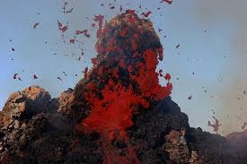
Volcanoes Erupting all over the world. No Rats Deserting the ship here.
We are not, I repeat, are not trying to scare you. We just thought you might like to know the truth, why the Rats are Deserting the Ship. But if you are unconcerned that’s fine because we really didn’t want to scare you. So you don’t have to prepare. You can join us because we have resolved ourselves to taking it as it comes. I AM not afraid to die, may sound strange, but I AM looking foreword to the moment. Ah, to be free at last. But that’s my choice. I don’t want to live on a ship infested with Rats. So for me it’s Parallel Realities and Dimensional Shifts. Or the Photon Belt ascension into fifth dimensional space.
The Rats are Deserting the Ship and now we all know why.
Knowledge is Power
Take your Power Back
And become the Light
CJC

The Rats are Deserting the Ship.
But we won’t Desert you we are all in this together
Disclaimer: This article is not intended to provide medical advice, diagnosis or treatment of any kind. We don’t imply or condone the breaking of any laws. For educational purposes Only. Or are we telling anybody to do anything regarding themselves. Nor, are we terrorists. We are all big boys and girls and can make up our own minds, if you government Clowns would just take the fluoride out of the water supplies.
Leave A Comment
You must be logged in to post a comment.